
|
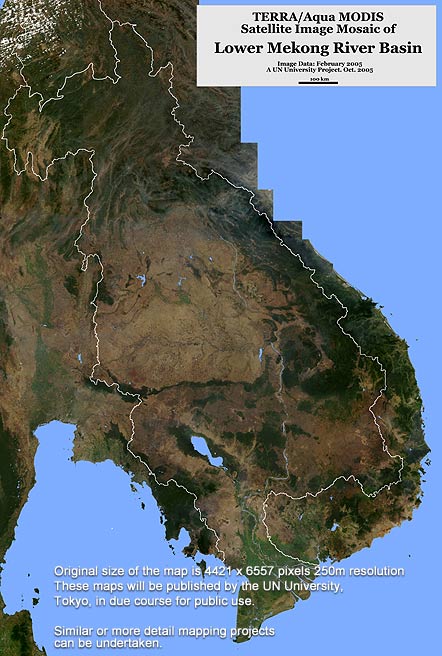
250m MODIS satellite image mosaic of lower Mekong River Basin.
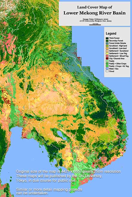
Land cover map of lower Mekong River Basin.
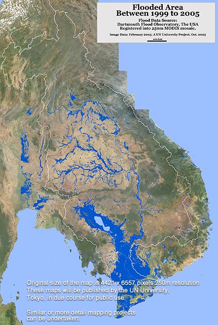
Flooded area of lower Mekong River Basin.
More maps will be added.
|
|
|
Graphics |
papers |
Research Papers In Proceedings |
and about me |